Resupply schedule for the Sierras–how to get through the Sierras with a 4-day bear canister.

The section through the Sierras is supposed to be rife with hungry bears. For this reason, there are lots of rules about food storage . In 2001, there were lots of rules too, but most thru-hikers ignored them and instead lived by their own rules which were: 1.Don’t cook where you camp 2.Don’t camp in established campsites, and 3. Sleep with your food. I didn’t see any bears in the Sierras that year, although I did see lots of bear poo.

Apparently the bears are more plentiful and aggressive this year and so there is a lot of persistent and emotional scuttlebutt flying around saying that you must absolutely have a bear canister. This is no small problem for people. Since many people carry 10 days, or more, worth of food through the Sierras because to resupply atBearikade Independence means hiking eighteen off trail miles.

The bear canisters are heavy. The lightest ones are made by Bearikade. They weigh 1lb 15oz(878 grams) for the 6 day model and 2lbs 5oz(1048 grams) for the 9 day model but BearVaultthey cost 250.00 and 275.00 dollars. They do have a rental program, but that isn’t cheap either.
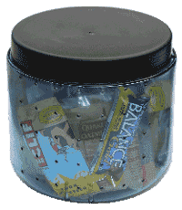
The other one is Bear Vault. Bearvaults weighs 2lbs 1 oz(935 grams)for the 4 day model and 2lbs 9 oz(1162 grams) for the 7 day model and cost between 60 and 80 dollars. They have discontinued their rental program but they will sell you a 7 day Bear Vault canister for 65 dollars and ship it free to Kennedy Meadows, Echo Lake or Tuolumne Meadows.    Bear Vault purchase program for PCT hikers.

If I decide to go with the four day model, here is how I could do it without putting in a bunch of off trail miles and backtracking to resupply:

  • Leave Kennedy Meadows with 2 days worth of food in bear canister (mile 702.8)
  • Hike down Trail Pass(744.8) to Horseshoe Meadows campground and hitch hike out to resupply at Lone Pine. Get 6 days of food–4 days in the canister, 2 days in food bag.
  • From Horseshoe Campground take Cotton wood pass(749.6) back up to the PCT–this way there is no backtracking.
  • The first night, camp either at Wallace creek(770.4), (774.3), or Tyndall Creek(775) and use the bear boxes there, to store food in.
  • The next night camp at Rae Lakes(794.8) and use the bear box there. (Actually, by the end of this day, I would only have four days of food left so I could camp anywhere)
  • Hike the next 4 days using my bear canister.
  • Resupply Vermilion Valley Resort(877.2)–get 1.5 days of food
  • Resupply Reds Meadow (906.6)or Mammoth Lakes.– get 1.5 days of food
  • Resupply Tuolumne Meadows (941.6) get 3 days of food
  • Resupply Sonora Pass(1018.3)Either at North Kennedy Meadows or Bridgeport. If I go to Bridgeport, I think I could send the food canister and ice ax home. Get 3.5 days worth of food.
  • Mail bear canister home or back to rental place from Echo Lake(1094.5).

Update: I made it the whole 200 miles from Kennedy Meadows to Reds Meadow with a Bear Vault 350. I was able to pack 20,000 calories into it. I also met a guy carrying a map entitled, “Sierra Nevada Wilderness food storage requirements” using that map he was able to legally make it through the Sierras without carrying a bear canister.

Related Post: Figuring out how much food to bring on a hike
My GPS

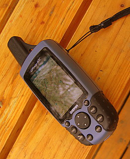
cabin2-149.jpgI bought the Garmin60c GPS to hike the CDT(Continental Divide Trail), after being told by a past thru-hiker that I would spend days lost if I didn’t carry a mapping GPS. The difference between a mapping GPS and regular GPS is that you can load it full of topo maps and then see where you are on the map. I wouldn’t have wanted to be out there without it.

It comes with a non deletable world map with all the major roads shown. Then you can add what maps you want, to it, from either a topo cd or you can go more urban and go with city maps. The topo maps show all water sources including wells. They show the mountains, contour lines, elevations, trails, roads and public institutions such as schools and fire houses. I have never had the city maps but I think they tell you about services in the cites like restaurants and stores. I don’t know if you can put both topos and city maps together. The map CD’s don’t come with the GPS and are an additional expense.

I was able to put all the topo maps for the entire CDT, plus about a fifty mile radius around the trail in it and still had room to spare. Right now, I have the topos for the entire state of Washington and most of Oregon it it. You can easily add markers on the unit and then push the goto button and it will navigate you there, either on roads or as the crow flies, which ever you choose. You can zoom in and out for more or less detail.

Garmin claims a 30 hour battery life. I used lithium batteries and got much longer then that. It was so efficient that I often hiked with it on all day . There is a model that has a compass that doesn’t have as long a battery life, but I think you can turn off the compass. This model has a compass but it doesn’t work unless you are moving.

I haven’t had any problems with it from getting it wet. I hike with it in the rain and strap it to the top of my kayak when I go out for a paddle.

It also tells you lots of other information like elevation, moving speed, timed stopped, etc.

I now have a little case for it. When I was on the CDT I didn’t have a case so I just taped some clear packing tape on the screen to protect it from getting scratched, which worked great, is light, and cheap.

It comes with a little strap and a clip. On the clip, you push a button and the unit comes unclipped from the clip. I loop the GPS through my backpack strap with the strap and then clip it my backpack using the clip. That way if the one of them should fail the other will hold it on.

It weighs 6.75 ounces(192 grams) with lithium batteries, 8.05 ounces(228 grams) if you add the case and clip.

After a month of constant use, the zoom button quit working. I sent it back to Garmin and they replaced the unit.

As is the way of electronics, now Garmin makes one that gets better signal in trees and canyons and has removable storage: the Garmin 60cx. It also looks like Garmin started making my model in a gray scale version, the Garmin 60, that will do everything mine does except without color and is considerably less than what I paid.

I’m not bringing it on the PCT, but when I hike the CDT I’ll definitely bring it. Since on the CDT the trail is often just not there.

One day on the CDT, on a hill, with the wind blowing about 35 miles an hour, I got out all my navigational aids: Jonathan Ley’s maps, Jim Wolf’s guide book, the National Forest Service map and my GPS with a past hiker’s way points in it, and tried to figure out which way to go. I knew that I wasn’t following the “official” CDT but until that moment, I didn’t realize that Jonthin Ley’s route, the guide book and my way points were all following different routes…and at that moment, I wasn’t on any of them.

I saw on my GPS, a place ten miles away that was in my guidebook so I just pointed my GPS towards where I wanted to go and took off hiking. As I set out on my own route, walking over the grassy hills, I thought, “I am happier, now, than I have ever been in my whole life.”

How much does it cost to hike a long trail?

The first long trail I hiked was the PCT(Pacific Crest Trail). I quit my good paying job and planned to return to work the following spring. I looked at the hike as a “trip of a lifetime” and spared no expense. But, like a lot of people that complete a long hike, once I finished the trail, I wasn’t so willing to sell my summers anymore and I still haven’t made it back to work.

Since then I have tried to practice a more sustainable hiking style. If I’m disciplined enough I will keep track of my PCT expenses this trip and see how much I spend.

There is a rule of thumb that everyone throws around that says 1-2 dollars a mile, but, Weathercarrot wrote this article on how he hiked the AT on 1,100 dollars: that’s freedom.

I was reading journals today and found a hiker who is paying for her trip by selling plasma.

Update: I spent about 3,600 dollars. That included buying a couple new pairs of shoes, a new backpack, and new rain gear.  I don’t drink and I tried to get out of town as quickly as I could but sometimes got a room.   I bought lots of fresh food no matter the cost.

A functional way to use a poncho/packcover

cabin2-122.jpgI used to carry a sil-nylon poncho as a ground cloth, figuring that it would do double duty as rain gear and pack cover. It worked fine as a ground cloth except it was really slippery but as a poncho it would just blow around and was really hard to take on and off by myself.
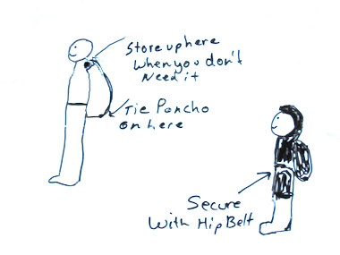
In the “How to hike the CDT” video, one of the hikers interviewed gave the following instructions for using a poncho:  Tie the back of the poncho to the bottom of your pack, flip up the rest behind your neck.  When you want the poncho on, just reach back and pull it over your head and secure with the waist belt of your pack. When you start getting too hot just un-lash your belt and pull the poncho up over your head and store behind your neck again.

That’s a really functional way to wear a poncho, however I have stopped using a ground cloth so I don’t carry it anymore.

When the skies get dark, climb high.

When I was hiking the PCT (Pacific Crest Trail) and stopping at Mojave for a resupply, an old man told me, “When the skies get dark, climb high”. It was a warning about flash floods in the desert.

Later I heard about a thru-hiker that camped in a dry river bed that year. He said that there were campfire rings in it and it looked well used for camping. That night he was woke up by a strong pressure pushing on him. He fought his way out of his sleeping bag and tarp to swim out of the way of the water. He said that if he had been in a tent he didn’t think he could have gotten out. He lost everything. And hiked into town with nothing but a t-shirt on. He also said that it wasn’t even raining where he was; the water must of come from rain up in the hills.

Sun gloves

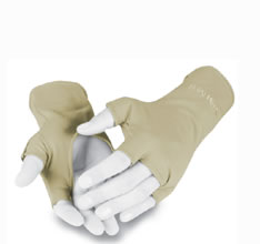
simmssungloves.jpgThis is my newest gear purchase: a pair of Simms sun gloves. I got them from TCO Fly Shop. They weigh .80(21 grams) of an ounce.

Sun block doesn’t stay on hands very long and most of it ends up polluting streams when a person stops to dip out some water. I think this might be a good solution for sun protection for hands. They are very light and cool.

Update: These are great.

The ultimate bug net.

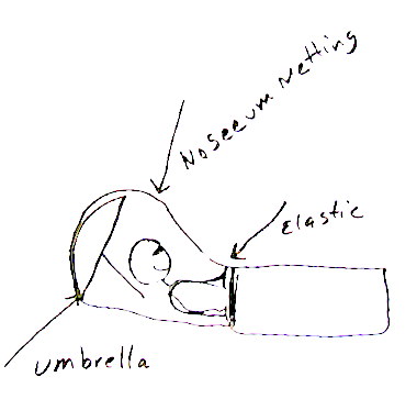
cabin2-113-1.jpgI have this idea: make a big bag out of no see um netting with elastic, lycra binding, or a draw cord at one end. Then throw the big bag over my umbrella when I’m hiking and secure it around my waist for the ultimate head net. At night, I could sleep under it, when the weather is nice but the bugs aren’t. Good idea?
SimBLISSity.net  sells something like this that weighs 4 oz.  (113 grams)  The Inner Peace bug free haven

Keeping the inside of your tent dry.

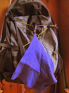
cabin2-112.jpgFor dealing with water inside my tent due to condensation or from wet clothes and gear, I carry a small camp towel. I cut it down; it weighs .9 of an ounce(26 grams).  I’m thinking of cutting it down some more to save weight; maybe even in half.
“It absorbs 10 times its weight in water and wringing removes 92% of water making it instantly ready for re-use.”

I wipe the walls of my tent down with it, wring it out and wipe some more. It is particularly useful in sopping up puddles in my tent. Some people say that you can use your bandanna, but a bandanna doesn’t absorb any water once it’s wet; it just smears the water around.

Mine came with a loop on it so I can loop it on to the back of my pack while it dries; you can sew one on if can’t find one with a loop or just use a safety pin.

It can also be used as a super absorbent bandage.

Related Post: Camp towel versus ShamWow!

Foot care

cabin2-108.jpgWhen I hiked the PCT(Pacific Crest Trail), a big callus developed on the ball of my foot. A lot of people had this happen and most were afraid to do anything about it because they thought, “If it hurts this much with the callus, it might hurt even worse without it.” When I finished my hike I read a lot about feet and went to a foot doctor. The doctor said that you shouldn’t let calluses develop there and that the callus it self can cause a lot of problems.
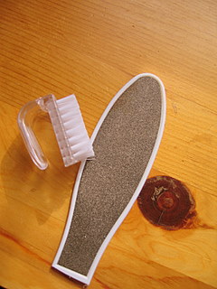
This year I’m bringing a callus file and a small scrub brush to take better care of my feet. I bought the smallest scrub brush I could find and, using a hacksaw, cut it in two. I also used the hacksaw to remove the handle from the file. They weigh 1/2 ounce(14 grams) each. The scrub brush is also good for cleaning up my gear.

For lotion for my feet I think I will bring anti-fungal cream, It’s unscented so it won’t attract bears and it will protect me from fungal infections. Update: I mostly used small tubes of Carmex.

Related Posts:

Tools for your feet 

Cracked Feet 

Stalking the elusive split toe tabi sock

Tabi socks!
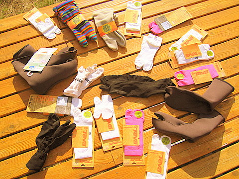
Armed only with a solar powered labtop and a dial up connection I have secured for my hike this rather impressive pile of tabi socks. I need tabi socks because I hike in Chacos Z2–sandals with a toe strap. I have 2 pairs of nylon socks I got from karate depot, 15 pairs of Teva bamboo socks I got off e-bay, 2 pairs of neoprene socks off e-bay and 2 pairs of fleece socks from sol socks. I could have just got toe socks but I think it takes to much time putting each toe in its’ own compartment.

The most elusive of all was the neoprene tabi sock. They come from Japan. The company that makes them is http://www.neoworkgear.info/ The only place I could find them was some guy on e-bay with a couple of pairs. I e-mailed the company but they never responded. I think I will trim the neoprene socks down a little to save weight.

Related post: Hiking in Sandals

Radios and mp3 players for the long distance hiker.

On a long hike I like to have something to listen to, sometimes. On the PCT(Pacific Crest Trail) I brought a little Awia Fm radio. It weighed 1.7 ounces without the battery. For the Florida trail and the Appalachian Trail I brought a 5 ounce Sony radio that had am/fm, weather channel and TV band.iriver1.jpg

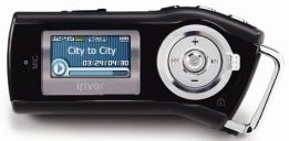
For the upcoming PCT trip I’m bringing the iriver T10 2gb MP3 player with fm radio. It weighs 1.7 ounces (48 grams) without battery. It has a little clip to clip it on to anything or clip it on to the neck lanyard it comes with.

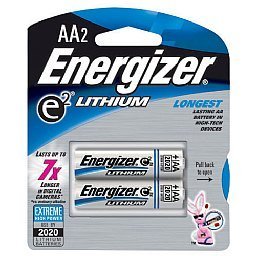
lithium.jpgIt takes one AA battery; the battery is supposed to last 45 hours. I put a lithium battery in it because it is lighter and last longer then a regular battery, so I’m thinking maybe it will last 100 hours on one battery.

If I super compress my files, I think I can get 100 hours of stuff on it. It also records, so a person could record their thoughts along the way with the built in microphone.

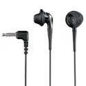
headphones.jpgIt comes with a pair of ear buds that won’t work because every time the wind blows they come out. So I have ordered a pair of Sony MDR-ED21LP Fontopia In-The-Ear Headphones, they weigh five grams (.18 ounces.) Even though they are in-the-ear style, they are supposed to allow you to hear what is going on around you. Update: I got the headphones. These are the same headphones that I have used for all my hikes. I thought they quit making them. They do indeed stay put when the wind blows yet they also let you hear what is going on around you. Highly recommended.

I find spoken words to be particularly helpful for letting my mind focus on something other then pain and boredomjohnnycash1.jpg. Last summer, my son downloaded, for me, 300 hours of “This American Life”, a NPR radio documentary show. Sadly I have listened to all 300 hours–twice. But that would have made great listening, on the trail.

What I like to listen to at home is not the same thing that will get me down the trail. For music on the trail, I find folk, country and show tunes the most effective hiking music, with most stuff by Johnny Cash being about the most perfect hiking tempo.

Buying maps– cut out the middle person

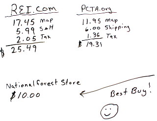
pacific-crest-1-thumb.jpgThere are some new maps out, of the PCT (Pacific Crest Trail). So far just Southern California and Northern Washington. I wanted to buy one. At the pcta.org cabin2-089.jpgsite it cost 19.31, total. REI sells it too, they sell it for a total price of 25.49. But if you go to the National Forest Store the same map only cost 10.00 dollars, free shipping, no tax. They sell lots of other maps too, of course.
Update: I got my map…. this thing is so durable you could use it as a place mat. One map weighs 6.3 ounces… too much to bring on a long hike.

Sawyer’s water purification– “No Pumping; No Chemicals; No Waiting; No Worries!”

sawyers-purification.jpg

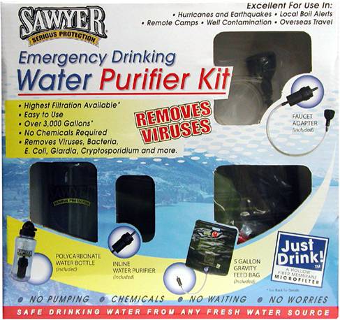
I was turned on to this system from reading the PCT-O7 yahoo group. These purifiers quickly remove bacteria and virus. They treat 3000 gallons– more if you back flush it. You can filter three ways: inline gravity feed which yields 5 gallons in 30 minutes, or sit on the bag and get it even faster, hook it up to a faucet and get it at 40 psi, or fill up the bottle and just drink. It says that there is no hard sucking involved.

I’m having a hard time getting more information on these. The inline filter weighs 6 oz, I believe, but I don’t know about the bottle filter. Aqua Mira– what I use– weighs 3 oz but only treats 30 gallons and that’s if you don’t accidentally not get the cap on tight. The biggest problem I have with Aqua Mira is running out of it on the trail.

On the PCT (Pacific Crest Trail) and the Appalachian the water is usually good and I didn’t feel I needed to treat much of my water, except in the desert, but on the Florida trail and at least the New Mexico section of the CDT (Continental Divide Trail) I was finding I needed to treat most of the water and ran out of Aqua Mira in the middle of nowhere and had to drink the cow spit straight up; it would be nice to have a water treatment that would last the whole trail, as I don’t like being bound to mail drops for my supplies.

Here is a link with more information http://www.sawyerproducts.com/viral.htm They are sold through http://www.justdrink.net/

Update:  I bought it and so far have not gotten it to work.  Read my review here

Light weight insulating jacket.

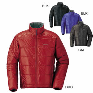
mont_bell_thermawrap.jpgThis is my new gear purchase: the Mont- Bell U.L. Thermawrap Jacket. It cost 111.20, including shipping, from Campsavers.com It will replace my Marmot dri-climb shirt and my Feathered Friends down vest. It’s suppose to weigh less then 8 oz (226 grams), in my size, and will save me 13 oz. (368 grams). It’s coming in the mail. I have high hopes for this jacket.

Update: It runs small and it wasn’t as warm as I had hoped.  I missed my down vest.

It brings the base weight of my pack down to under 10lbs (4.5 Kilograms). Of course, if a person were to add an ice ax, a bear canister, and a pair of running shoes– so they wouldn’t have to hike in the snow in sandals– it would increase another 4.5 lbs(2 kilograms).